3 Datasets
3.1 Overview
This page documents the datasets used in the Marshall Fire analysis.
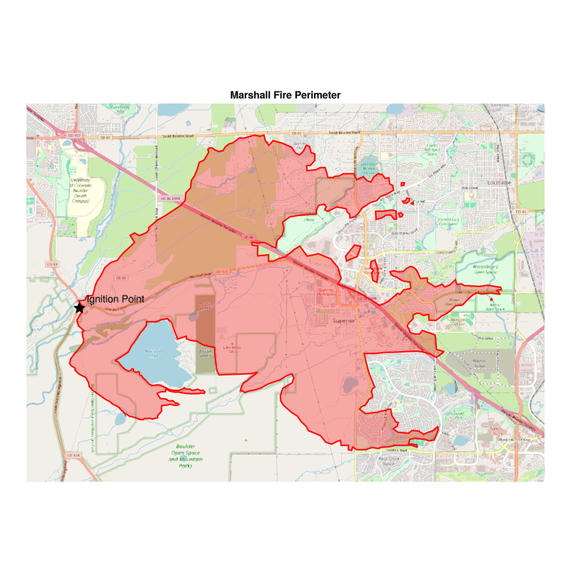
3.2 Fire Perimeter
The official Marshall Fire perimeter from Boulder County Open Spatial Data, available as GeoJSON.
3.3 Landfire Data
Landfire provides fuel, vegetation, and terrain data for fire modeling. The following layers are used:
- FBFM13/FBFM40: Fire Behavior Fuel Model
- SLP: Slope (degrees)
- ASP: Aspect (degrees from north)
3.4 HRRR Wind Data
High-Resolution Rapid Refresh (HRRR) provides hourly wind field data at 3km resolution. Wind components:
- u: East-west wind component (m/s)
- v: North-south wind component (m/s)
3.4.1 Wind Animation
3.5 Data Sources
| Dataset | Source | Resolution |
|---|---|---|
| Fire Perimeter | Boulder County ArcGIS | Vector |
| Landfire | USGS | 30m |
| HRRR | NOAA | 3km, hourly |